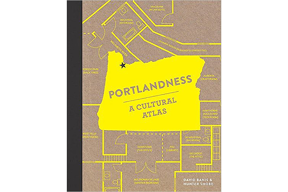
Portland State geography professors David Banis and Hunter Shobe presented their new book, Portlandness: A Cultural Atlas, as part of the annual 10-day Portland State of Mind celebration of knowledge and culture, on Wednesday, Oct. 27.
In an entertaining presentation, Banis and Shobe described the evolution of their project, from class assignments to a published book. Initially, they asked students to come up with things that define Portland and mapped each one of those, such as liberalness, environmentalism, breweries and food carts.
In some ways the results weren’t surprising, like the fact that there are more breweries in Portland than any other city in the world. But they worried that talking about Portland in a statistical way leaves out a lot and might just stereotype Portland.
“What we need to do is explore other ways of seeing other parts of Portland,” Banis said.
They aimed to capture a sense of place, questioning what defines Portland, what makes it different from any other place in the world, and represent that graphically through a cultural atlas.
“A cultural atlas is something that challenges our geographic imaginations and provides us with different cartographies we’re not used to seeing, and asks us to see places from the perspectives of other people,” Shobe said.
Banis explained that while we tend to trust the authority of maps, we forget there is a cartographer picking and choosing what’s on that map, thereby telling a story.
A lot of maps use the same conventions, so they tried to use as many different cartography and map styles as possible “to not only get people to think differently about Portland, but also to get people to think differently about maps,” Shobe said.
In this vein, they encouraged their contributors to be as creative as possible.
Banis and Shobe shared many of the book’s maps, including a map of Portland in the style of the London Tube (featuring a “Hipster Line” that basically wanders and goes nowhere), a map of security cameras downtown (over 400) so you can track a route with the least surveillance, a map of wait times for brunch, a map of backyard beekeepers and the loss of hives, and a map of city plans that never came to fruition (including grand boulevards, a network of freeways, water taxis and Olympics host venues).
“We’re trying to suggest different ways to pay attention to your city,” Banis said. “There’s so much interesting stuff. When we travel we have a tendency to be hyper-observant, but we aren’t that way in our own cities.”
They also included mental maps, featuring the illustrations from a third-grade class, mapping the city from their perspectives. Other maps reveal surprising paradoxes; despite being the third-whitest metropolitan area, 55 different languages are spoken at Portland’s David Douglas High School.
Many of the maps have a humorous, quirky edge, but some also represent the city’s internal conflict, like the discriminatory process of redlining and gentrification in the Mississippi district.
Banis and Shobe described the laborious process from ideas to manuscript draft to choosing a publisher to editing with a graphic designer to finalizing the finished product. It was a giant collaboration of over a hundred people who helped develop the ideas for the book and who volunteered their time.
“The most significant part of working as a cartographer on Portlandness was the level of collaboration and the way that collaboration helped the pages evolve throughout the project,” said Corinna Kimball-Brown, one of the cartographers. “There were many ideas that came out of Hunter and David’s classes and then were discussed and iterated upon by the core group of cartographers and researchers for months or even years.”
Another cartographer and recent transplant to Portland, Randy Morris, explained how the project helped him discover parts of the city he never would have found on his own. “Just looking through the book shows such a diversity of perspectives, environments and stories,” Morris said. “Not just from the authors’ points of view, but from that of all the cartographers, and the data as well.”
Portlandness is about capturing the city from the experience of those who actually live here, not the New York Times’s notion of the city which, according to Banis and Shobe, tends to portray an upscale, self-consciously quirky version that is very limited. The project has inspired Shobe to walk around neighborhoods he doesn’t usually go to.
Banis now sees Portland as a mix of interconnected stories. He explains that urban issues are often put forth as simple choices instead of complex ones that should consider a variety of perspectives.
“I think we all have a tendency to see the city through our own personal lens and not through the eyes of the many fellow citizens [who] we do not know,” Banis said.
The audience, mostly comprised of their students, was engaged and laughing throughout the presentation. Boisterous, excited conversation followed. Jessica Beutler, a former student of Shobe, came back for the event.
“It’s fun to come out and support them,” Beutler said. “I’m really excited to get [the book], personally. It’s definitely on my Christmas list.”


